Waking up in Beechworth felt like waking up in a small coastal village in the Scottish Highlands: the weather and landscape fitted almost perfectly. We headed back – this time along the main road instead of hammering along a dirt track again – to Georgetown for food, a look around, and to stage a photo. Georgetown was settled by the British to fend off the French from staking a claim on the north coast so it seemed almost a crime – as a British guy travelling with a French guy – not to pay homage to the history of the town. In the end, we went to the supermarket and got distracted by ‘Aussie burgers’ (they’re cut in the shape of Australia; we were a bit disappointed they didn’t chuck in a lump of mince off the south coast to represent Tassie) and forgot all about the photo. We did fit in a look at the light-house at Low Head, and found it odd that the number of performers on the street (I almost forgot, there was a festival on in town) embarrassingly outnumbered the visitors.
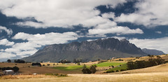
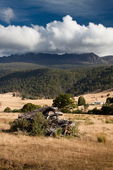
Back in free-shower-locating-mode, we headed towards Lilydale, stopping on the way at Hollybank Forest Reserve to eat our Aussie burgers, play some shithead, and drink some bubbly with a rather nice local who passed through while we were there. The showers at Lilydale weren’t free, and there was a wedding being held, so we looked a little out of place. We checked out the Lilydale falls but, in the dry season, they weren’t up to much, then headed on to an area of the island with a special interest to me. In the north-east of Tasmania there is a hill of the same height and name as Ben Nevis in Scotland so naturally I thought it would be cool to climb it, especially since I’ve never conquered the Scottish peak. Driving out of Launceston into Ben Lomond National Park, the scenery started to gain height and turn more like that of the drive towards Aviemore from Dufftown and the dull day had cleared up into something that lit up the landscape brilliantly. We had the not so helpful combination of a map that marked the peak of Ben Nevis, but not the roads around it, and Google Maps on my phone, which marked tracks way beyond the capability of our vehicle but didn’t say exactly where Ben Nevis was, so we never did find the peak, but my gps was playing that afternoon so when I checked the log later it showed we were circling the right hill.
After another few hours of driving some fun forest tracks in the middle of nowhere and never quite knowing where we were, we hit the out fringe of civilisation at the Mathinna campground. By this time the sun was setting and we were past the point of caring about getting a shower today, and were more glad that we knew where we were again. For being so far from anything, we were amazed to find possibly the most organised 21st birthday weekend ever cranking up: about 20 people had turned up with maybe a dozen cars, a few trail bikes, a generator, floodlights, a massive tarp hung from a few trees, full size cooking stoves, and a chain-saw create the fuel for the respectable bonfire that sucked everyone in as the temperature dropped. We didn’t expect to meet many people in Tassie, least not out here, so it was nice to kick back with a few beers for an evening under the stars with a few locals.