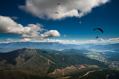
For over a month I’d been soaring over Mystic, using the looming lump of Mount Buffalo to the west to gauge how high I was, but I’d yet to make the mere 25km trip to the mountain. Leanne and Greg thought we could go up there and camp out for a night around their day off – being the owners of the hostel and the jewellery shop, and living in Bright, means they can get away with closing the shop and letting the hostel run its self every Tuesday. As the Tuesday came around, they couldn’t make it, but in their usual super-kind fashion they chucked enough gear in their 4×4 for Crystal and I to start a Polar expedition, and let us drive up to Buffalo ourselves. Seriously, I can’t go on enough about just how lucky I was to stay at their hostel and have them help me in so many ways.
Tuesday came, and Crystal – a Canadian who’d came to pick grapes at Boynton’s winery – and I headed out past Porepunkah, up the Mt Buffalo Road. As with most of Australia’s national parks there are fees for entering and I think it was about $18 for us to take the car in, which made it really surprising that to reserve a camping spot beside Lake Catani only pushed that up to about $25. The drive up is steep and winding: great since I was driving, but the trees blocked out most of the views of the lowlands that fell away around us as we headed to the plateau.
I’d only had my laptop for a week or so and was itching to try some time-lapse photography, now that I had a way of automatically triggering the camera. Lake Catani, surrounded by reeds, and with a few ducks and a canoe floating around in the ever-changing light, was too good an opportunity to miss so I perched the laptop on a rock at the lake’s edge and left the kit doing its thing for about half an hour, while I blitzed through the crisps I’d bought in the name of ’emergency supplies’. The campsite was set a few hundred metres from the lake, and when we found our site we realised the park ranger had given us one of the best spots, sheltered under trees at the edge of the site, with an unrestricted view of the lake. The tent Greg had packed turned out to be a small mansion, possibly visible from space, well, at least the other side of the lake.
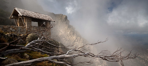
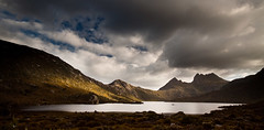
Next we headed to The Horn – I didn’t know anything about where the best sights on the massif were so was trusting Crystal’s experience – first reaching the lookout, perched on the edge of a cliff with mist washing up the face. Thoughts of the Himalayas came to me as parts of the rocky landscape revealed themselves but for moments through the waves of mist. Up at the peak, the view was impressive, albeit over a landscape that felt anonymous to me as a new-comer to the area. The cloud-base not far above my head was breaking up the light across the plateau in a fairly interesting way so I tried another time-lapse, looking back across the Giant’s Playground to our next stop: The Cathedral.
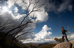
We decided to climb the hill across the road from the Cathedral, as Crystal hadn’t been up it, but got distracted by a huge and precariously-perched rock and the prehistoric-looking landscape behind it, and ended up chilling in the calm sunny afternoon there for a while. We followed a track downhill a little bit and ended at a base of a hill made up entirely of massive boulders, so big I had to leave my camera at the bottom before trying out my pretty non-existent bouldering skills, but I managed to get up far enough to get a nice view over where we’d came from.
We ended up at the Chalet to watch the sunset from the top of monumental drop into the gorge. We were really on the wrong side of Buffalo as the sun was setting over by the Horn lookout, but at least at this side the landscape of the Ovens Valley was much more recognisable, stretching from the Eurobin – where I’d worked on a berry farm – back to Bright and the Mystic Launch. Back at the lake I thought I’d be warm enough with my roll-mat and a few blankets, but about an hour in I had to go back on that plan and get the sleeping bag out before I went hypothermic.
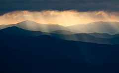
Deciding the view from the Chalet at sunrise would definitely be worth getting up for, we did exactly that and I set up a time-lapse at the hang-gliding launch ramp. The launch ramp is just a 5-meter timber ramp rolling off to the sheer +500m drop to the bottom of the gorge in a ridiculously scary fashion. I tried to stand on it but dared only put one foot on the sloped part of it. While the laptop and old camera were doing their thing, the sun broke through the clouds casting some amazingly strong and focussed rays across the valley, keeping me fixated with the other camera for the next hour. It was good to be sitting in one spot, focussing on one scene, instead of running around from place to place trying to capture as many sights as possible while not really giving any one them the attention it deserved to create a truly decent shot.
I was pretty sure I was rostered on at the brewery for 1pm that day, giving us time to pack up and check out one or two sights on the way back to Bright. I’ve found some brilliant spots, both in Australia and back home, just by taking the more obscure roads, and that thinking led us down a dirt track with the perfect mix of corners and crests to make haring along it really fun. Luckily Crystal seemed to trust my driving along the road that branched off near the snow-clearing station and led to a few walking tracks that led back in the direction of the Cathedral. We didn’t make it as far as we wanted as I was worried about not making it back to Bright in time and it’d definitely be worth a revisit. The worrying was well-justified: getting back to Bright at 11.30 I phoned in to check when I was starting, ’15 minutes’, oops..

